Skip to content

As-built documentation, virtual tours, and floor plans for designers, engineers, and architects.

As-built documentation, virtual tours, and floor plans for designers, engineers, and architects.

A quick and precise method for property documentation is provided by planarscan. Spend less time and money.

planarscan surveys rapidly and effectively generates visuals and dimensions data for planning, building, and analysing places, eliminating the guesswork involved in mapping and recording built environments. For Architects, Engineers, and Construction Professionals to be able to concentrate on the task at hand, planarscan delivers trustworthy and precise survey tools for gathering square footage data and producing defendable floor plans.


planarscan offers all the tools you require to precisely measure a space and generate accurate floor plans. Not to mention the capability of evaluating crucial data inside the virtual environment, saving you time and money by avoiding needless site visits

Whether you work in architecture, construction, or engineering, we can assist you in streamlining the procedure for obtaining the spatial intelligence you require to make decisions remotely, communicate effectively, and coordinate with clients and specialists around the world.


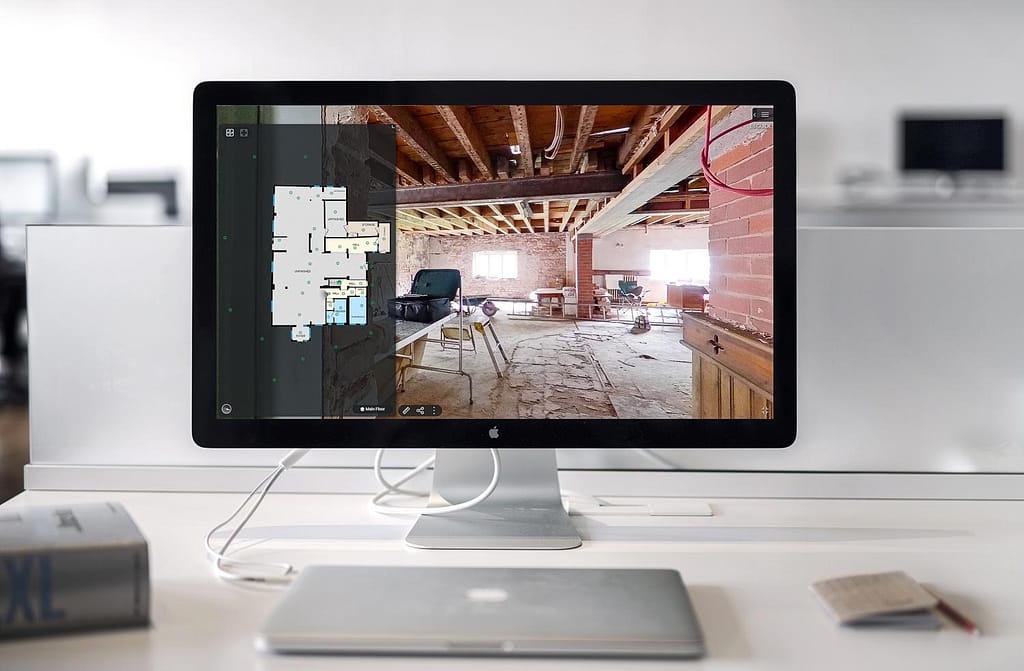
architectural survey with planascan 2d lidar floor plans 3d virtual tours

Floor plans, 360° panoramas, room measurements, and photos from planarscan can be valuable. Spend less money and time by:

  • Half your survey time with our planarscan technology
  • Investigating a property before, during, and after renovation and construction
  • DXF file ‘point cloud’ to help create 3D models
  • The ability to make decisions and move about in unfamiliar environments by virtually exploring precise 2D and 3D layouts.
  • Create a permanent visual record of your spaces for future reference
  • Distance measurements in 3D space between various points
  • Submitting your 360-degree photos for Google Street View so that people may see your work
  • Fostering interaction and assisting in the dissemination of essential property information
  • Using experts remotely while saving money on travel
  • Site-invisible environmental comprehension and simplified teamwork on large projects
  • What-if scenario planning, equipment acquisition, safety protocols, layout and configuration updates, etc.
  • Calculating the best placement and route for heavy machinery without having to physically inspect the site in advance
  • Customizing the visuals and adding tags to the locations of important features, assets, risks, etc.
  • 24-hour* turnaround on floor plans and virtual tours, allowing you to start projects much faster


Want to know more about our floor plans, click here


Planarscan is proud to work with

Image of a Libray in London from Google Street View. What is a virtual tour: - planarscan
Virtual Tours

What is a Virtual Tour?

What is a virtual tour? A virtual tour is an interactive and immersive experience that allows users to explore a space remotely,
Read More »

All in one solution for surveys, 3D tours and Floor plans

Want to learn how planarscan may provide you with a competitive advantage? Fill out our form below to talk to a team member!